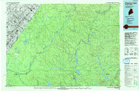
1993 Map of Clayton Lake
USGS Topo · Published 1994About this map
The remote borderlands of northern Maine and Quebec converge in this 1993 topograhic study, centered on the deep forests and intricate waterways of the North Woods. The Allagash Wilderness Waterway anchors the eastern half of the map, tracing a chain of significant bodies including Umsaskis Lake, Long Lake, and Priestly Lake. These waters have long served as essential corridors for timber and recreation, connected by landmarks like the Ninemile Bridge and Priestly Bridge. Along the western boundary, the international border is marked by the Maine United States line and the Saint-Pamphile crossing, complete with a Port of Entry and nearby Landing Strip. Scattered camps and historic sites such as Harvey Farm, Michaud Farm, and Blanchette Camp reflect the area's legacy of wilderness homesteading and seasonal sporting traditions within the watershed of the St John River.
Find a feature on this map
62 named features on this map. Tap any name to fly to it.
Don’t see what you’re looking for? This feature index may not catch every label — zoom into the map to look around manually.
Map Details
Editions of this 1993 Clayton Lake Map
This is the sole edition of this map. No revisions or reprints were ever made.
Other maps of this area

1930 · Allagash
USGS Topo · 1:48,000

1930 · St Francis
USGS Topo · 1:48,000

1931 · Fish River Lake
USGS Topo · 1:48,000

1931 · Mooseleuk Lake
USGS Topo · 1:48,000

1932 · Umsaskis Lake
USGS Topo · 1:48,000

1932 · Musquacook Lakes
USGS Topo · 1:48,000

1932 · Allagash Falls
USGS Topo · 1:48,000

1933 · Allagash
USGS Topo · 1:62,500

1933 · St Francis
USGS Topo · 1:62,500

1935 · Umsaskis Lake
USGS Topo · 1:62,500