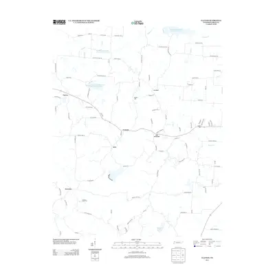
2013 Map of Clayton
USGS Topo · Published 2013About this map
Old Fremont and neighboring Fremont anchor this rural landscape in Obion County, characterized by a transition from the rolling terrain near Mathis Hill to the watershed of Reelfoot Indian Creek Number Fourteen Lake. The settlement patterns here are distinctly tied to the local road network, where legacy family names are preserved on routes like W Newman Glover Rd and Todd Thomas Rd. In the southern portion of the map, Dixie and Protemus represent small community hubs within a highly managed agricultural environment, evidenced by the presence of Garrison's Poultry Farm. The region's hydrology is complex, featuring engineered water management such as the Reelfoot Indian Creek Watershed Number Seven Reservoir, which supports the agricultural drainage into Cane Cr and Snapneck Cr along the Tennessee-Kentucky border.
Find a feature on this map
94 named features on this map. Tap any name to fly to it.
Don’t see what you’re looking for? This feature index may not catch every label — zoom into the map to look around manually.
Map Details
Editions of this 2013 Clayton Map
This is the sole edition of this map. No revisions or reprints were ever made.
Other maps of this area

1925 · Reelfoot Lake
USGS Topo · 1:62,500

1939 · Reelfoot Lake
USGS Topo · 1:62,500

1939 · Hickman
USGS Topo · 1:62,500

1939 · Bayouville
USGS Topo · 1:62,500

1950 · Obion
USGS Topo · 1:24,000

1950 · Rives
USGS Topo · 1:24,000

1951 · Obion
USGS Topo · 1:24,000

1951 · Rives
USGS Topo · 1:24,000

1951 · Cayce
USGS Topo · 1:24,000

1951 · Bondurant
USGS Topo · 1:24,000