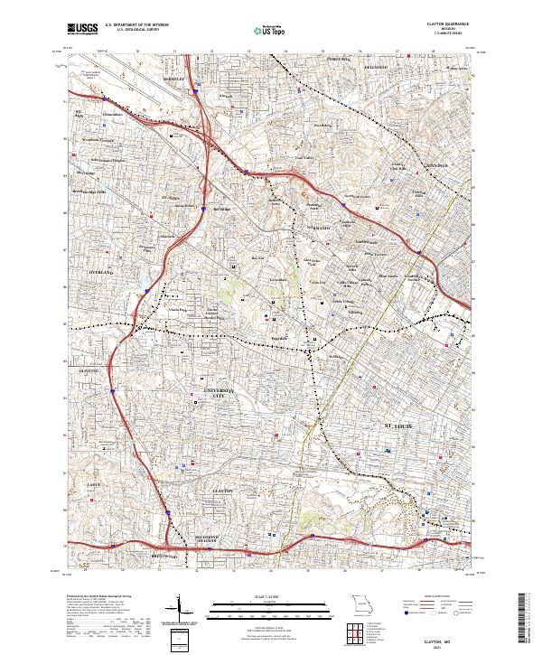
2021 Map of Clayton
USGS Topo · Published 2021About this map
The Saint Louis County Courthouse and surrounding civic center in Clayton serve as the primary hub for this densely populated corridor of St. Louis County. This survey detail highlights a sophisticated landscape of higher education and institutional heritage, featuring the Washington University in Saint Louis Danforth Campus, Fontbonne University, and Concordia Seminary. The map illustrates the complex urban geometry of established municipalities like Normandy, University City, and Jennings, intersected by major arteries such as Interstate 170 and Interstate 70.
Find a feature on this map
91 named features on this map. Tap any name to fly to it.
Don’t see what you’re looking for? This feature index may not catch every label — zoom into the map to look around manually.
Map Details
Editions of this 2021 Clayton Map
This is the sole edition of this map. No revisions or reprints were ever made.
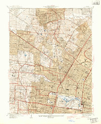
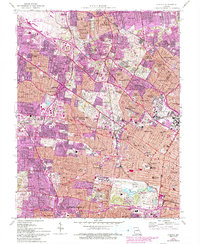
Historical Maps of Velda Village Hills Through Time
4 maps found