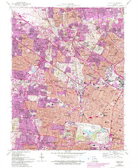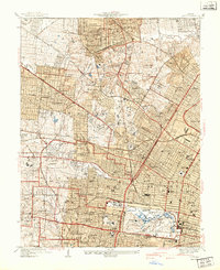
1941 Map of Clayton
USGS Topo · Published 1941About this map
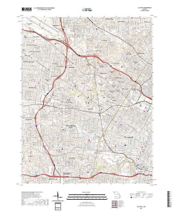
St Louis and its burgeoning western suburbs are captured here at the start of the 1940s, revealing a landscape defined by institutional campuses and early aviation history. The northern reaches are dominated by Lambert Field St Louis Airport, while the academic corridors of Washington University and Concordia Seminary anchor the development near Clayton. The area's social geography is mapped through numerous golf courses like Norwood Hills Country Club and expansive greenspaces including Forest Park, which houses the Art Museum and Municipal Theater. Heavy rail infrastructure from the Wabash RR and the St Louis Terminal RR cuts through the street grid, serving the industrial needs of neighborhoods like Wellston and Jennings. This survey provides a precise look at the transition from urban density to residential townships such as University City, Richmond Heights, and Normandy before the post-war housing boom fundamentally altered the remaining open tracts.
Find a feature on this map
93 named features on this map. Tap any name to fly to it.
Don’t see what you’re looking for? This feature index may not catch every label — zoom into the map to look around manually.
Map Details
Editions of this 1941 Clayton Map
2 editions found

Historical Maps of University City Through Time
7 maps found