
1927 Map of Alton
USGS Topo · Published 1927About this map
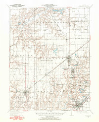
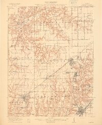
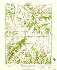
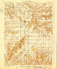
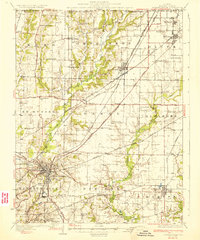
The confluence of the Mississippi River and Missouri River serves as the focal point for this industrial and riverfront landscape during the mid-1940s revision. This survey illustrates the dense rail and industrial development surrounding Alton, East Alton, and Wood River, where the Illinois Terminal RR and St Louis and Alton Electric RR reflect a transit-heavy era. The map provides significant genealogical value through its dense documentation of rural schools such as Ingersoll Sch, Mason Sch, and Hines Sch, alongside established institutions like the Monticello Seminary. Large-scale civil and state projects are evident, including the Alton State Hospital and the City of St Louis Farms south of Spanish Lake. The intricate system of islands and bottoms, such as Chouteau Island and St Ferdinand Bottom, reveals a landscape defined by flood control and river navigation before modern urbanization dominated the region.
Find a feature on this map
84 named features on this map. Tap any name to fly to it.
Don’t see what you’re looking for? This feature index may not catch every label — zoom into the map to look around manually.
Map Details
Editions of this 1927 Alton Map
This is the sole edition of this map. No revisions or reprints were ever made.
Other maps of this area

1888 · St. Louis
USGS Topo · 1:62,500

1907 · Belleville
USGS Topo · 1:62,500
1912 · Gillespie
USGS Topo · 1:62,500
1915 · Gillespie
USGS Topo · 1:62,500
1925 · Brighton
USGS Topo · 1:62,500

1927 · St. Charles
USGS Topo · 1:62,500

1927 · Edwardsville
USGS Topo · 1:62,500
1928 · Brighton
USGS Topo · 1:62,500

1930 · Jerseyville
USGS Topo · 1:62,500
1932 · Edwardsville
USGS Topo · 1:62,500