
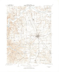
1930 Map of Jerseyville
USGS Topo · Published 1965About this map
Jerseyville serves as the central hub of this 1930s landscape, where the Chicago and Alton RR and the Chicago Springfield and St Louis RR intersect. This era reveals a dense network of rural infrastructure, with nearly every section of land supported by a local schoolhouse, such as Mt Gilead Sch, Woodbury Sch, and White Rose Sch. The map documents the distinct locations of Kane and Old Kane, while the County Farm sits west of the city center near the headwaters of Boyer Creek.
Find a feature on this map
94 named features on this map. Tap any name to fly to it.
Don’t see what you’re looking for? This feature index may not catch every label — zoom into the map to look around manually.
Map Details
Editions of this 1930 Jerseyville Map
2 editions found
Other maps of this area

1903 · O'Fallon
USGS Topo · 1:125,000

1924 · Roodhouse
USGS Topo · 1:62,500

1925 · Brighton
USGS Topo · 1:62,500

1926 · Roodhouse
USGS Topo · 1:62,500

1927 · Alton
USGS Topo · 1:62,500

1927 · St. Charles
USGS Topo · 1:62,500

1928 · Brighton
USGS Topo · 1:62,500

1930 · Pearl
USGS Topo · 1:62,500

1930 · Hardin
USGS Topo · 1:62,500

1931 · Brussels
USGS Topo · 1:62,500