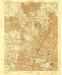
1941 Map of Clayton
USGS Topo · Published 1941About this map
Washington University and the extensive grounds of Forest Park anchor the urban landscape of this 1930s-era survey, revealing the dense institutional and residential growth west of the city center. The map documents a corridor of higher education and healthcare, featuring Fontbonne College, Concordia Seminary, and several major hospitals including Jewish Hospital and St Johns Hospital. Transit networks are well-established, with the Wabash RR and St Louis Terminal RR cutting through the suburbs of University City and Richmond Heights.
Find a feature on this map
118 named features on this map. Tap any name to fly to it.
Don’t see what you’re looking for? This feature index may not catch every label — zoom into the map to look around manually.
Map Details
Editions of this 1941 Clayton Map
2 editions found
Other maps of this area

1888 · St. Louis
USGS Topo · 1:62,500

1924 · Robertson
USGS Topo · 1:24,000

1927 · Alton
USGS Topo · 1:62,500

1927 · St. Charles
USGS Topo · 1:62,500

1933 · Creve Coeur
USGS Topo · 1:24,000

1933 · Granite City
USGS Topo · 1:24,000

1933 · Jefferson Barracks
USGS Topo · 1:24,000

1933 · Cahokia
USGS Topo · 1:24,000

1933 · Clayton
USGS Topo · 1:24,000

1933 · Saint Charles
USGS Topo · 1:62,500