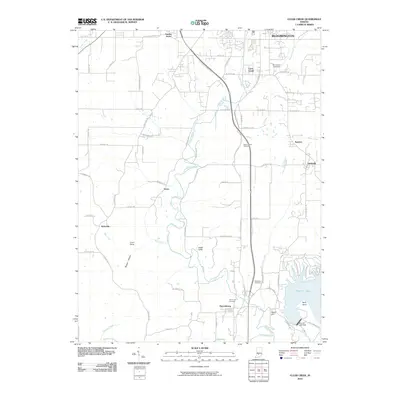
2010 Map of Clear Creek
USGS Topo · Published 2010About this map
Bloomington serves as the northern anchor for this 2010 study of Monroe County, which transitions from urban development to the managed waters of Monroe Lake. The landscape is defined by the winding course of Clear Creek and its many tributaries, including May Creek and Little Clear Creek, which carve through the terrain near landmarks like Cedar Cliffs and Crum Point. The map illustrates the southern expansion of the county seat toward unincorporated communities such as Victor and Sanders. Significant infrastructure is visible at the Monroe Lake Dam on Salt Creek, where the river's flow is regulated south of Depot Hill. Local history is preserved through numerous family and community sites, including Clover Hill Cemetery near Harrodsburg and the Bloomington Speedway, documenting the area's social and recreational layout at the start of the 21st century.
Find a feature on this map
70 named features on this map. Tap any name to fly to it.
Don’t see what you’re looking for? This feature index may not catch every label — zoom into the map to look around manually.
Map Details
Editions of this 2010 Clear Creek Map
This is the sole edition of this map. No revisions or reprints were ever made.
Other maps of this area

1908 · Bloomington
USGS Topo · 1:48,000

1910 · Bloomington
USGS Topo · 1:62,500

1934 · Bedford
USGS Topo · 1:48,000

1935 · Oolitic
USGS Topo · 1:48,000

1937 · Bedford
USGS Topo · 1:62,500

1942 · Franklin
USGS Topo · 1:125,000

1942 · Oolitic
USGS Topo · 1:62,500

1947 · Allens Creek
USGS Topo · 1:24,000

1947 · Unionville
USGS Topo · 1:24,000

1953 · Indianapolis
USGS Topo · 1:250,000