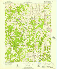
1956 Map of Clear Creek
USGS Topo · Published 1957About this map
The limestone industry of southern Indiana is deeply etched into this mid-century landscape, characterized by numerous Limestone Quarries scattered across the central corridor. The Monon Railroad and the Illinois Central lines serve as the backbone for local commerce, connecting small settlements like Harrodsburg, Smithville, and Victor. These rail lines follow the valley floor near Clear Creek, providing the essential infrastructure for transporting stone from the region's busy quarries.
Find a feature on this map
51 named features on this map. Tap any name to fly to it.
Don’t see what you’re looking for? This feature index may not catch every label — zoom into the map to look around manually.
Map Details
Editions of this 1956 Clear Creek Map
This is the sole edition of this map. No revisions or reprints were ever made.
Other maps of this area

1908 · Bloomington
USGS Topo · 1:48,000

1910 · Bloomington
USGS Topo · 1:62,500

1934 · Bedford
USGS Topo · 1:48,000

1935 · Oolitic
USGS Topo · 1:48,000

1937 · Bedford
USGS Topo · 1:62,500

1942 · Franklin
USGS Topo · 1:125,000

1942 · Oolitic
USGS Topo · 1:62,500

1947 · Allens Creek
USGS Topo · 1:24,000

1947 · Unionville
USGS Topo · 1:24,000

1953 · Indianapolis
USGS Topo · 1:250,000