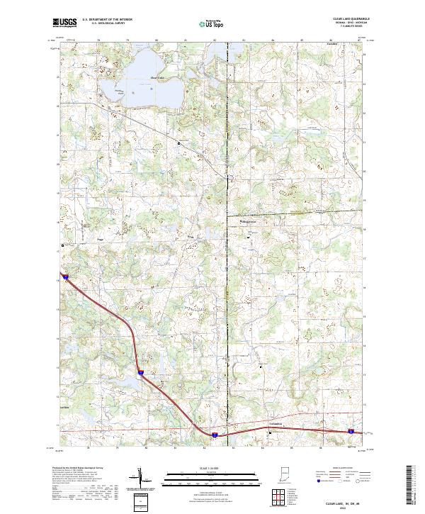
2022 Map of Clear Lake
USGS Topo · Published 2022About this map
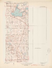
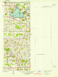
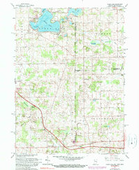
The tri-state boundary where Indiana, Michigan, and Ohio converge anchors this detailed study of the lakes and rural townships at the corner of Steuben, Hillsdale, and Williams Counties. The landscape is defined by a dense cluster of glacial water bodies, most notably Clear Lake with its prominent Paradise Point, surrounded by smaller neighbors like Lake Anne, Mirror Lake, and Handy Lake. These lakes have long served as focal points for local settlement, evidenced by the intricate network of roads like Lake Drive Clear Lake and Outer Dr Clear Lake that ring the shoreline.
Find a feature on this map
76 named features on this map. Tap any name to fly to it.
Don’t see what you’re looking for? This feature index may not catch every label — zoom into the map to look around manually.
Map Details
Editions of this 2022 Clear Lake Map
This is the sole edition of this map. No revisions or reprints were ever made.
Historical Maps of Camden Township Through Time
5 maps found