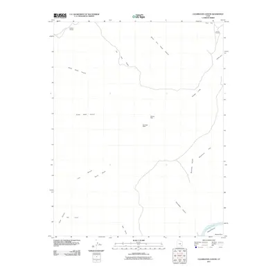
2011 Map of Clearwater Canyon
USGS Topo · Published 2011About this map
Simplot Airstrip provides a remote point of access at the northern edge of this high desert terrain, where the plateau drops toward the Colorado River Cataract Canyon. The landscape is defined by its dramatic verticality, characterized by the Orange Cliffs and the prominent The Big Ridge which separates deep drainage systems. Navigation through this area relies on features like Sunset Pass and the Flint Trail Overlook, which offer vantage points over the complex network of dry washes and deep-cut gorges such as Clearwater Canyon and South Fork Happy Canyon. The presence of the airstrip and named geographic points like Gunsight Butte and Bowdie Point suggests the sparse human footprint in a region dominated by the sheer scale of its canyons and flats.
Find a feature on this map
20 named features on this map. Tap any name to fly to it.
Don’t see what you’re looking for? This feature index may not catch every label — zoom into the map to look around manually.
Map Details
Editions of this 2011 Clearwater Canyon Map
This is the sole edition of this map. No revisions or reprints were ever made.
Other maps of this area

1885 · San Rafael
USGS Topo · 1:250,000

1886 · Henry Mountains
USGS Topo · 1:250,000

1892 · Henry Mountains
USGS Topo · 1:250,000

1952 · Mouth of Dark Canyon
USGS Topo · 1:62,500

1952 · Hite
USGS Topo · 1:62,500

1953 · Orange Cliffs 3 SE
USGS Topo · 1:24,000

1953 · Orange Cliffs 4 NW
USGS Topo · 1:24,000

1953 · Orange Cliffs 4 NE
USGS Topo · 1:24,000

1953 · Orange Cliffs 3 NE
USGS Topo · 1:24,000

1953 · Orange Cliffs 4 SW
USGS Topo · 1:24,000