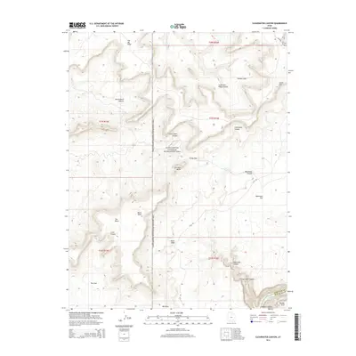
2014 Map of Clearwater Canyon
USGS Topo · Published 2014About this map
Glen Canyon National Recreation Area dominates this section of San Juan County, where the Colorado River's path through Cataract Canyon feeds into the northern reaches of Lake Powell. The landscape is defined by massive geological benches and vertical relief, ranging from the high elevations of the Orange Cliffs and The Big Ridge down to the recessed floors of Cove Canyon and Clearwater Canyon. The cartography captures a wilderness largely inaccessible by traditional roads, instead relying on primitive routes like the Flint Trl and Roost Rd to navigate the high ground. Distinctive landmarks such as Gunsight Butte and Lands End provide orientation points across the expansive Waterhole Flat, while names like Black Ledge and The Block highlight the sheer verticality of the canyon country.
Find a feature on this map
29 named features on this map. Tap any name to fly to it.
Don’t see what you’re looking for? This feature index may not catch every label — zoom into the map to look around manually.
Map Details
Editions of this 2014 Clearwater Canyon Map
This is the sole edition of this map. No revisions or reprints were ever made.
Other maps of this area

1885 · San Rafael
USGS Topo · 1:250,000

1886 · Henry Mountains
USGS Topo · 1:250,000

1892 · Henry Mountains
USGS Topo · 1:250,000

1952 · Mouth of Dark Canyon
USGS Topo · 1:62,500

1952 · Hite
USGS Topo · 1:62,500

1953 · Orange Cliffs 3 SE
USGS Topo · 1:24,000

1953 · Orange Cliffs 4 NW
USGS Topo · 1:24,000

1953 · Orange Cliffs 4 NE
USGS Topo · 1:24,000

1953 · Orange Cliffs 3 NE
USGS Topo · 1:24,000

1953 · Orange Cliffs 4 SW
USGS Topo · 1:24,000