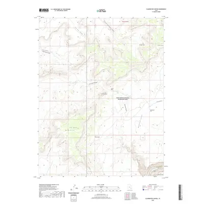
2020 Map of Clearwater Canyon
USGS Topo · Published 2020About this map
Orange Cliffs and Lands End define the high plateau topography of this San Juan County landscape, where deep drainages have carved into the canyonlands. Much of the southern portion of the map is preserved within the Glen Canyon National Recreation Area, protecting a complex network of dry washes and canyons including Waterhole Canyon and Clearwater Canyon. This 2020 survey illustrates a wilderness nearly devoid of permanent structures, where the primary human footprint consists of unpaved routes like Doll House Road and N Hatch Canyon Rd. To the southwest, the terrain drops toward the Colorado River corridor at Cataract Canyon, bordered by prominent landmarks such as Gunsight Butte and the long precipice of Black Ledge. The map serves as a detailed record of the erosion patterns across Waterhole Flat and the varied points and ridges that separate these significant canyon systems.
Find a feature on this map
23 named features on this map. Tap any name to fly to it.
Don’t see what you’re looking for? This feature index may not catch every label — zoom into the map to look around manually.
Map Details
Editions of this 2020 Clearwater Canyon Map
This is the sole edition of this map. No revisions or reprints were ever made.
Other maps of this area

1885 · San Rafael
USGS Topo · 1:250,000

1886 · Henry Mountains
USGS Topo · 1:250,000

1892 · Henry Mountains
USGS Topo · 1:250,000

1952 · Mouth of Dark Canyon
USGS Topo · 1:62,500

1952 · Hite
USGS Topo · 1:62,500

1953 · Orange Cliffs 3 SE
USGS Topo · 1:24,000

1953 · Orange Cliffs 4 NW
USGS Topo · 1:24,000

1953 · Orange Cliffs 4 NE
USGS Topo · 1:24,000

1953 · Orange Cliffs 3 NE
USGS Topo · 1:24,000

1953 · Orange Cliffs 4 SW
USGS Topo · 1:24,000