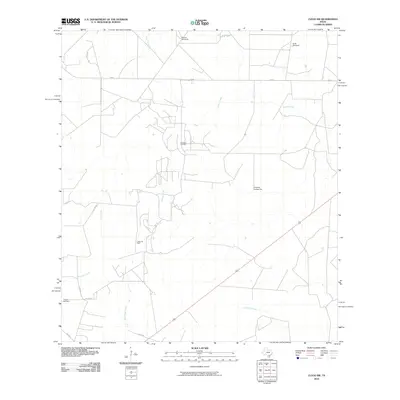
2010 Map of Clegg SW
USGS Topo · Published 2010About this map
Campana Oil Field and the Labbe Oil Field mark the industrial character of this South Texas landscape in McMullen County. The terrain is defined by a sparse network of ranch roads and cattle-range landmarks, notably the Windmill Number Six, Rincon Windmill, and Soda Windmill, which reflect the region's reliance on groundwater management. The hydrological system is composed of several intermittent drainages, including Lagarto Creek, Cow Creek, and San Jose Creek, which flow toward the southeastern corner of the quadrangle. For those researching local burial sites, the Campos Cemetery is located in the southwestern quadrant near the junction of Co RD 405 and Co RD 406. This survey provides a precise look at the ranching and petroleum infrastructure just prior to the 2010s, showing the intersection of FM 624 and FM 824.
Find a feature on this map
20 named features on this map. Tap any name to fly to it.
Don’t see what you’re looking for? This feature index may not catch every label — zoom into the map to look around manually.
Map Details
Editions of this 2010 Clegg SW Map
This is the sole edition of this map. No revisions or reprints were ever made.
Other maps of this area

1920 · Mikeska
USGS Topo · 1:125,000

1937 · Loma Alta
USGS Topo · 1:62,500

1953 · Crystal City
USGS Topo · 1:250,000

1955 · Crystal City
USGS Topo · 1:250,000

1956 · Rosita Ranch
USGS Topo · 1:62,500

1956 · Freer
USGS Topo · 1:62,500

1956 · Laredo
USGS Topo · 1:250,000

1961 · Crystal City
USGS Topo · 1:250,000

1968 · Crystal City
USGS Topo · 1:250,000
1969 · Clegg
USGS Topo · 1:24,000