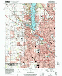
2022 Map of Clermont
USGS Topo · Published 2022About this map
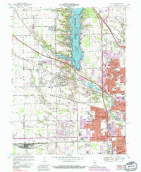
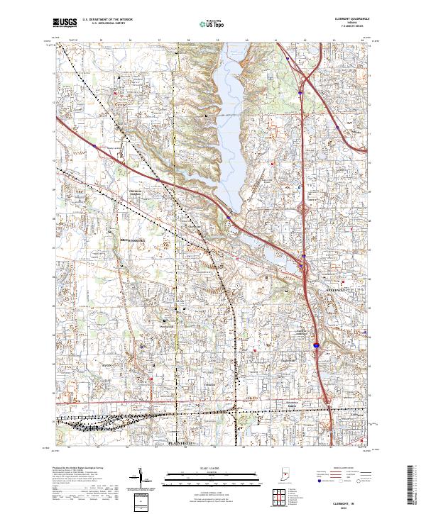
Eagle Creek Reservoir dominates the central landscape of this western Marion County area, where suburban expansion meets the established corridor of the B & O RR. The map details the transition between Clermont and the western edge of Speedway, characterized by a dense network of residential additions like Farleys Addition and Clermont Heights. For genealogists, the sheet is particularly dense with burial sites, including family-named plots such as Ballard Cem, Walker Cem, and Turpin Cem, alongside denominational sites like Salem Baptist Cem.
Find a feature on this map
120 named features on this map. Tap any name to fly to it.
Don’t see what you’re looking for? This feature index may not catch every label — zoom into the map to look around manually.
Map Details
Editions of this 2022 Clermont Map
This is the sole edition of this map. No revisions or reprints were ever made.
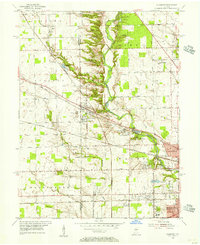
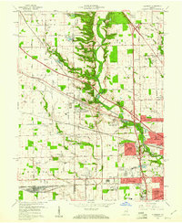
Historical Maps of Indianapolis Through Time
5 maps found