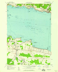
1957 Map of Cleveland
USGS Topo · Published 1959About this map
Oneida Lake dominates this mid-century landscape, serving as a central hub for the waterfront communities of Constantia, Cleveland, and Lakeport. The map reveals a shoreline defined by specific local landmarks such as Shackleton Point and the Cornell Univ Biological Field Sta, which highlights the area's importance for academic research. Inland, the transition from agricultural land to protected areas is evident in the Cicero Game Management Area and the wetlands of Cicero Swamp.
Find a feature on this map
75 named features on this map. Tap any name to fly to it.
Don’t see what you’re looking for? This feature index may not catch every label — zoom into the map to look around manually.
Map Details
Editions of this 1957 Cleveland Map
2 editions found
Other maps of this area

1895 · Chittenango
USGS Topo · 1:62,500

1895 · Syracuse
USGS Topo · 1:62,500

1898 · Syracuse
USGS Topo · 1:62,500

1898 · Chittenango
USGS Topo · 1:62,500

1902 · Chittenango
USGS Topo · 1:62,500

1905 · Mexico
USGS Topo · 1:62,500

1906 · Kasoag
USGS Topo · 1:62,500

1938 · Syracuse East
USGS Topo · 1:24,000

1940 · Cicero
USGS Topo · 1:24,000

1941 · Cleveland
USGS Topo · 1:24,000