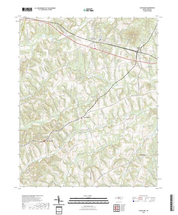
2022 Map of Cleveland
USGS Topo · Published 2022About this map
Cleveland stands as the primary hub of this western Rowan County landscape, where the Norfolk Southern railway corridor runs parallel to Old US Hwy 70. The topography is defined by the drainage basins of Third Creek, Withrow Creek, and Sills Creek, creating a network of ridges and bottoms that have historically influenced the placement of rural settlements like Bear Poplar and Mount Ulla. To the northeast, Youngs Mtn provides a rare point of significant elevation overlooking the agricultural plains.
Find a feature on this map
104 named features on this map. Tap any name to fly to it.
Don’t see what you’re looking for? This feature index may not catch every label — zoom into the map to look around manually.
Map Details
Editions of this 2022 Cleveland Map
This is the sole edition of this map. No revisions or reprints were ever made.
Other maps of this area

1893 · Statesville
USGS Topo · 1:125,000

1953 · Charlotte
USGS Topo · 1:250,000

1954 · Charlotte
USGS Topo · 1:250,000

1960 · Charlotte
USGS Topo · 1:250,000

1962 · Charlotte
USGS Topo · 1:250,000

1969 · Cooleemee
USGS Topo · 1:24,000

1969 · Cool Springs
USGS Topo · 1:24,000

1969 · Shepherds
USGS Topo · 1:24,000
1969 · Mooresville
USGS Topo · 1:24,000
1969 · Rowan Mills
USGS Topo · 1:24,000