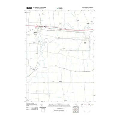
2010 Map of Clifton Springs
USGS Topo · Published 2010About this map
Hill Cumorah rises in the northern portion of this Ontario County region, overlooking a landscape defined by the winding course of the Canandaigua Outlet. This waterway serves as the historical corridor for the primary settlements of Manchester, Shortsville, and Clifton Springs, which are connected by a network of local roads and rail lines. The area is exceptionally dense with burial sites of genealogical interest, including the Pioneers Cemetery, Saint Agnes Cemetery, and the Manchester Water Works Village Cemetery, reflecting generations of settlement and community development.
Find a feature on this map
77 named features on this map. Tap any name to fly to it.
Don’t see what you’re looking for? This feature index may not catch every label — zoom into the map to look around manually.
Map Details
Editions of this 2010 Clifton Springs Map
This is the sole edition of this map. No revisions or reprints were ever made.
Other maps of this area

1899 · Palmyra
USGS Topo · 1:62,500

1900 · Macedon
USGS Topo · 1:62,500

1900 · Canandaigua
USGS Topo · 1:62,500

1902 · Phelps
USGS Topo · 1:62,500

1902 · Palmyra
USGS Topo · 1:62,500

1903 · Canandaigua
USGS Topo · 1:62,500

1942 · Canandaigua
USGS Topo · 1:31,680
1942 · Canandaigua Lake
USGS Topo · 1:31,680

1942 · Rushville
USGS Topo · 1:31,680

1942 · Stanley
USGS Topo · 1:31,680