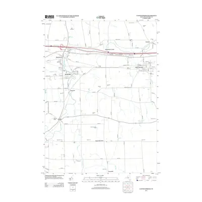
2013 Map of Clifton Springs
USGS Topo · Published 2013About this map
Hill Cumorah rises in the northern reaches of this Ontario County landscape, a significant landmark in a region defined by its glacial terrain and agricultural history. The Canandaigua Outlet carves a path through the western portion of the map, linking the industrial and residential centers of Manchester and Shortsville. This waterway was historically vital for power and transport, and its banks are lined with evidence of long-term settlement, including the Manchester Water Works.
Find a feature on this map
131 named features on this map. Tap any name to fly to it.
Don’t see what you’re looking for? This feature index may not catch every label — zoom into the map to look around manually.
Map Details
Editions of this 2013 Clifton Springs Map
This is the sole edition of this map. No revisions or reprints were ever made.
Other maps of this area

1899 · Palmyra
USGS Topo · 1:62,500

1900 · Macedon
USGS Topo · 1:62,500

1900 · Canandaigua
USGS Topo · 1:62,500

1902 · Phelps
USGS Topo · 1:62,500

1902 · Palmyra
USGS Topo · 1:62,500

1903 · Canandaigua
USGS Topo · 1:62,500

1942 · Canandaigua
USGS Topo · 1:31,680
1942 · Canandaigua Lake
USGS Topo · 1:31,680

1942 · Rushville
USGS Topo · 1:31,680

1942 · Stanley
USGS Topo · 1:31,680