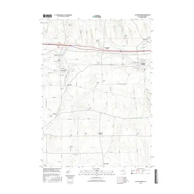
2016 Map of Clifton Springs
USGS Topo · Published 2016About this map
Hill Cumorah stands as a prominent topographical and cultural landmark in this section of Ontario County, rising north of the Canandaigua Outlet. The waterway threads through the industrial and residential centers of Manchester and Shortsville, where the concentration of cemeteries like Village Cem and Brookside Cem reflects generations of local settlement. Further east, the village of Clifton Springs is defined by its organized street grid and proximity to Clifton Springs Reservoir.
Find a feature on this map
100 named features on this map. Tap any name to fly to it.
Don’t see what you’re looking for? This feature index may not catch every label — zoom into the map to look around manually.
Map Details
Editions of this 2016 Clifton Springs Map
This is the sole edition of this map. No revisions or reprints were ever made.
Other maps of this area

1899 · Palmyra
USGS Topo · 1:62,500

1900 · Macedon
USGS Topo · 1:62,500

1900 · Canandaigua
USGS Topo · 1:62,500

1902 · Phelps
USGS Topo · 1:62,500

1902 · Palmyra
USGS Topo · 1:62,500

1903 · Canandaigua
USGS Topo · 1:62,500

1942 · Canandaigua
USGS Topo · 1:31,680
1942 · Canandaigua Lake
USGS Topo · 1:31,680

1942 · Rushville
USGS Topo · 1:31,680

1942 · Stanley
USGS Topo · 1:31,680