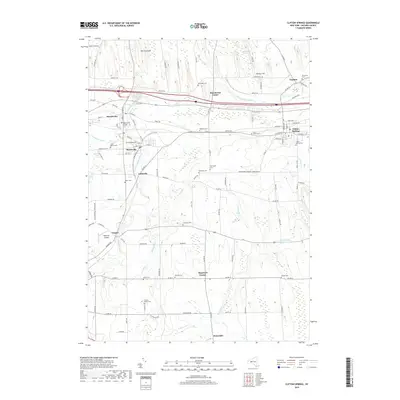
2019 Map of Clifton Springs
USGS Topo · Published 2019About this map
Hill Cumorah rises prominently in the northern landscape, anchoring an area defined by its dense cluster of historic settlements and burial grounds. This 2019 survey of the Ontario County countryside reveals a complex network of village centers including Manchester, Shortsville, and Clifton Springs, linked by the winding course of the Canandaigua Outlet. The map provides exceptional genealogical value through its identification of numerous community and family cemeteries, such as the Pioneers Cem, Sunnyside Cem, and Manchester Village Cem. The pattern of development follows the water and rail corridors, with smaller hamlets like Littleville and Chapin situated along the creek. Further south, the landscape opens into agricultural tracts near Hopewell Center and Ennerdale, while technical infrastructure like the Hopewell Airpark and the Clifton Springs Reservoir reflect the modern utility of this storied upstate New York terrain.
Find a feature on this map
111 named features on this map. Tap any name to fly to it.
Don’t see what you’re looking for? This feature index may not catch every label — zoom into the map to look around manually.
Map Details
Editions of this 2019 Clifton Springs Map
This is the sole edition of this map. No revisions or reprints were ever made.
Other maps of this area

1899 · Palmyra
USGS Topo · 1:62,500

1900 · Macedon
USGS Topo · 1:62,500

1900 · Canandaigua
USGS Topo · 1:62,500

1902 · Phelps
USGS Topo · 1:62,500

1902 · Palmyra
USGS Topo · 1:62,500

1903 · Canandaigua
USGS Topo · 1:62,500

1942 · Canandaigua
USGS Topo · 1:31,680
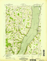
1942 · Canandaigua Lake
USGS Topo · 1:31,680

1942 · Rushville
USGS Topo · 1:31,680

1942 · Stanley
USGS Topo · 1:31,680