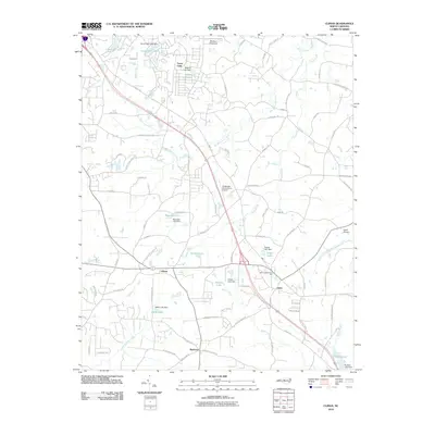
2010 Map of Climax
USGS Topo · Published 2010About this map
Climax and Julian serve as the primary hubs in this southern Guilford County landscape, where the transition from residential clusters to agricultural land is defined by numerous small private impoundments. The geography is dominated by the drainage patterns of Big Alamance Creek and Sandy Creek, which feed a series of named reservoirs such as Forest Oaks Lake, Quaker Lake, and Teague Lake. In Forest Oaks, a distinct pattern of suburban development contrasts with the more traditional rural layout seen around Redcross. Small-scale aviation is a notable characteristic of the area, evidenced by the proximity of MaMay AiAirport, Southeast Greensboro Airport, and Kecks Airport. This 2010 survey illustrates a region where local recreation at Gilmore Memorial Park and established road networks like Old Climax Rd and Bethlehem Church Rd anchor the community's daily life.
Find a feature on this map
87 named features on this map. Tap any name to fly to it.
Don’t see what you’re looking for? This feature index may not catch every label — zoom into the map to look around manually.
Map Details
Editions of this 2010 Climax Map
This is the sole edition of this map. No revisions or reprints were ever made.
Other maps of this area

1951 · Greensboro
USGS Topo · 1:24,000

1952 · Mc Leansville
USGS Topo · 1:24,000

1953 · Raleigh
USGS Topo · 1:250,000

1953 · Greensboro
USGS Topo · 1:250,000

1954 · Greensboro
USGS Topo · 1:250,000

1954 · Raleigh
USGS Topo · 1:250,000

1962 · Greensboro
USGS Topo · 1:250,000

1966 · Greensboro
USGS Topo · 1:250,000

1970 · Gibsonville
USGS Topo · 1:24,000

1970 · Kimesville
USGS Topo · 1:24,000