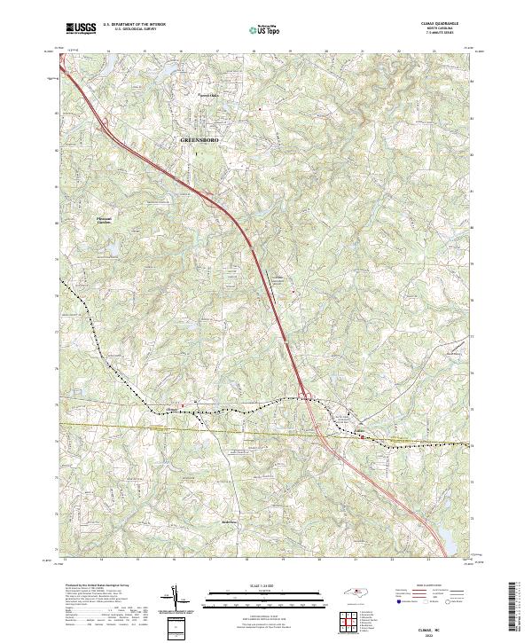
2022 Map of Climax
USGS Topo · Published 2022About this map
Climax and Julian anchor the southern edge of this modern Piedmont landscape, where the transition from the Greensboro suburban fringe to rural Randolph County is clearly visible. The terrain is defined by the headwaters of several key drainage systems, including the meandering path of Big Alamance Cr and the unique nomenclature of N Prong Stinking Quarter Cr. Numerous small reservoirs and private impoundments such as Quaker Lake, Teague Lake, and Reynolds Lake dot the landscape, reflecting the local history of land use and water management in the region. Aviation history is represented by the Southeast Greensboro Airport and Kecks Airport, while local community spaces are highlighted by the Doctor Clyde M Gilmore Memorial Park. The map also captures the residential expansion in areas like Forest Oaks and Pleasant Garden, illustrating how the road network has evolved to connect these historically distinct settlements.
Find a feature on this map
185 named features on this map. Tap any name to fly to it.
Don’t see what you’re looking for? This feature index may not catch every label — zoom into the map to look around manually.
Map Details
Editions of this 2022 Climax Map
This is the sole edition of this map. No revisions or reprints were ever made.
Other maps of this area

1951 · Greensboro
USGS Topo · 1:24,000

1952 · Mc Leansville
USGS Topo · 1:24,000

1953 · Raleigh
USGS Topo · 1:250,000

1953 · Greensboro
USGS Topo · 1:250,000

1954 · Greensboro
USGS Topo · 1:250,000

1954 · Raleigh
USGS Topo · 1:250,000

1962 · Greensboro
USGS Topo · 1:250,000

1966 · Greensboro
USGS Topo · 1:250,000

1970 · Gibsonville
USGS Topo · 1:24,000

1970 · Kimesville
USGS Topo · 1:24,000