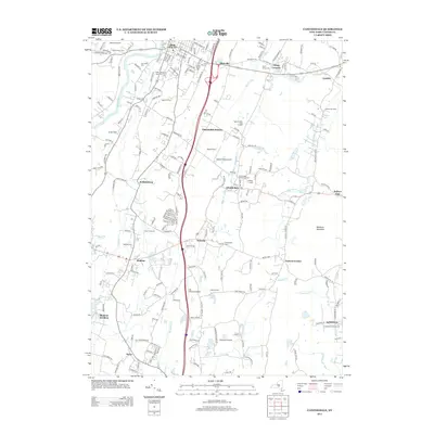
2013 Map of Clintondale
USGS Topo · Published 2013About this map
New Paltz and its surrounding Ulster County hamlets are documented in this 2013 survey, showcasing a landscape where academic life and agricultural roots sit side-by-side. The presence of the SUNY College at New Paltz campus anchors the northern portion of the map, while the terrain transitions southward toward the orchards and ridges of Marlboro Mountain. The area’s settlement patterns are clearly defined by clusters like Clintondale, Modena, and Ardonia, connected by a network of local roads that pass by active agricultural sites such as Apple Hill Farm and Wallkill View Farm.
Find a feature on this map
198 named features on this map. Tap any name to fly to it.
Don’t see what you’re looking for? This feature index may not catch every label — zoom into the map to look around manually.
Map Details
Editions of this 2013 Clintondale Map
This is the sole edition of this map. No revisions or reprints were ever made.
Other maps of this area

1893 · Poughkeepsie
USGS Topo · 1:62,500

1894 · Poughkeepsie
USGS Topo · 1:62,500

1898 · Rhinebeck
USGS Topo · 1:62,500

1901 · Rosendale
USGS Topo · 1:62,500

1903 · Poughkeepsie
USGS Topo · 1:62,500

1903 · Newburg
USGS Topo · 1:62,500

1903 · Rosendale
USGS Topo · 1:62,500

1934 · Rhinebeck
USGS Topo · 1:48,000

1936 · Poughkeepsie
USGS Topo · 1:48,000

1939 · Rhinebeck
USGS Topo · 1:62,500