
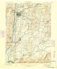
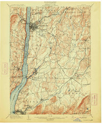
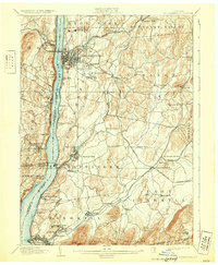
1903 Map of Poughkeepsie
USGS Topo · Published 1903About this map
The Hudson River serves as the central artery for this late-19th-century landscape, dividing the riverfront industrial and institutional hubs from the interior agricultural valleys. In Poughkeepsie, a dense street grid meets prominent educational and medical landmarks like Vassar College and the Hudson River State Hospital. Further south, the Asylum for Insane Criminals reflects the era's institutional development near Matteawan.
Find a feature on this map
98 named features on this map. Tap any name to fly to it.
Don’t see what you’re looking for? This feature index may not catch every label — zoom into the map to look around manually.
Map Details
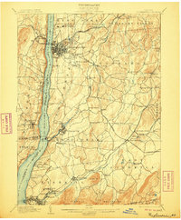
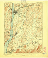
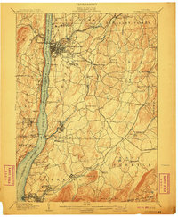
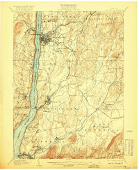
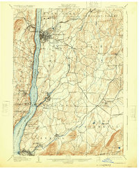
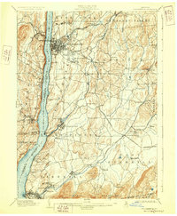
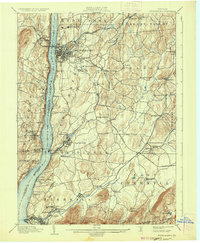
Editions of this 1903 Poughkeepsie Map
11 editions found
1903 edition
16.6 x 20.2 inches
1904 edition
16.6 x 20.1 inches
1906 edition
16.6 x 20.1 inches
1908 edition
16.6 x 20.1 inches
1910 edition
16.6 x 20.1 inches
1913 edition
16.7 x 20.2 inches
1917 edition
16.6 x 20.2 inches
1925 edition
16.6 x 20.1 inches
1928 edition
16.6 x 20.1 inches
1931 edition
16.6 x 20.2 inches
1936 edition
16.6 x 20.1 inches
Other maps of this area

1892 · West Point
USGS Topo · 1:62,500

1892 · Carmel
USGS Topo · 1:62,500

1893 · Carmel
USGS Topo · 1:62,500

1893 · Clove
USGS Topo · 1:62,500

1893 · Poughkeepsie
USGS Topo · 1:62,500

1894 · West Point
USGS Topo · 1:62,500

1894 · Clove
USGS Topo · 1:62,500

1894 · Carmel
USGS Topo · 1:62,500

1894 · Poughkeepsie
USGS Topo · 1:62,500

1898 · Clove
USGS Topo · 1:62,500