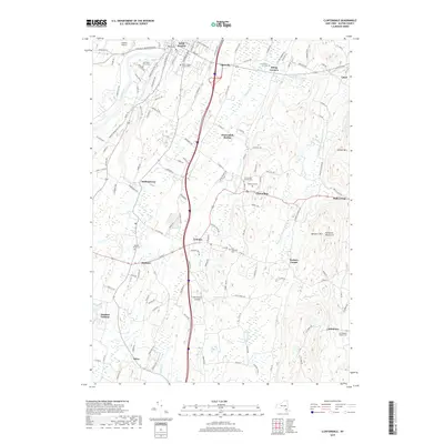
2019 Map of Clintondale
USGS Topo · Published 2019About this map
New Paltz and the surrounding Hudson Valley landscape are defined here by a mix of academic, agricultural, and residential patterns. The northern edge of the map is dominated by the SUNY College at New Paltz campus and the winding Wallkill River, which flows past the New Paltz Rural Cem. To the south, the terrain becomes increasingly varied as it rises into the Marlboro Mountains and Illinois Mtn. Small aviation sites like Stanton Airport and Old Orchard Airpark dot the countryside, reflecting the area's transition into a modern exurban hub.
Find a feature on this map
137 named features on this map. Tap any name to fly to it.
Don’t see what you’re looking for? This feature index may not catch every label — zoom into the map to look around manually.
Map Details
Editions of this 2019 Clintondale Map
This is the sole edition of this map. No revisions or reprints were ever made.
Other maps of this area

1893 · Poughkeepsie
USGS Topo · 1:62,500

1894 · Poughkeepsie
USGS Topo · 1:62,500

1898 · Rhinebeck
USGS Topo · 1:62,500

1901 · Rosendale
USGS Topo · 1:62,500

1903 · Poughkeepsie
USGS Topo · 1:62,500

1903 · Newburg
USGS Topo · 1:62,500

1903 · Rosendale
USGS Topo · 1:62,500

1934 · Rhinebeck
USGS Topo · 1:48,000

1936 · Poughkeepsie
USGS Topo · 1:48,000

1939 · Rhinebeck
USGS Topo · 1:62,500