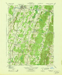
1943 Map of Clintondale
USGS Topo · Published 1943About this map
New Paltz and its southern agricultural hinterlands are captured in this mid-century Army Map Service survey, which highlights a landscape of orchards and small crossroads settlements. The transition from the Wallkill River in the northwest to the prominence of Marlboro Mountain in the southeast defines the region's topography. Transportation networks are well-established, with the New York Central and Hudson River and the New York New Haven and Hartford railroads providing vital connections for local produce and industry.
Find a feature on this map
43 named features on this map. Tap any name to fly to it.
Don’t see what you’re looking for? This feature index may not catch every label — zoom into the map to look around manually.
Map Details
Editions of this 1943 Clintondale Map
This is the sole edition of this map. No revisions or reprints were ever made.
Other maps of this area

1893 · Poughkeepsie
USGS Topo · 1:62,500

1894 · Poughkeepsie
USGS Topo · 1:62,500

1898 · Rhinebeck
USGS Topo · 1:62,500

1901 · Rosendale
USGS Topo · 1:62,500

1903 · Poughkeepsie
USGS Topo · 1:62,500

1903 · Newburg
USGS Topo · 1:62,500

1903 · Rosendale
USGS Topo · 1:62,500

1934 · Rhinebeck
USGS Topo · 1:48,000

1936 · Poughkeepsie
USGS Topo · 1:48,000

1939 · Rhinebeck
USGS Topo · 1:62,500