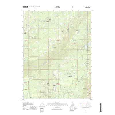
2018 Map of Clipper Mills
USGS Topo · Published 2018About this map
Clipper Mills and Woodleaf anchor this high-elevation landscape within the Plumas National Forest and Tahoe National Forest, where the topography is defined by the deep drainage of the S Fork Feather River. The map shows a region shaped by early mountain transport and hydraulic management, evidenced by the presence of the Lost Creek Dam and the winding course of the Old La Porte Rd. Scattered settlements like Rogerville, Lumpkin, and Oroleve are linked by a network of ridge-top roads including Fields Ridge Rd and Ponderosa Rd. Significant geographic landmarks such as Lumpkin Ridge, Mooreville Ridge, and Sugar Pine Point overlook the numerous creeks and gulches that feed the river system, including Sucker Run and Bear Gulch. This survey captures the modern road systems of Forbestown Rd and Hodgkins Ln as they serve these remote mountain communities.
Find a feature on this map
106 named features on this map. Tap any name to fly to it.
Don’t see what you’re looking for? This feature index may not catch every label — zoom into the map to look around manually.
Map Details
Editions of this 2018 Clipper Mills Map
This is the sole edition of this map. No revisions or reprints were ever made.
Other maps of this area

1888 · Smartsville
USGS Topo · 1:125,000

1888 · Bidwell Bar
USGS Topo · 1:125,000

1891 · Bidwell Bar
USGS Topo · 1:125,000

1891 · Smartsville
USGS Topo · 1:125,000

1892 · Smartsville
USGS Topo · 1:125,000

1893 · Bidwell Bar
USGS Topo · 1:125,000

1894 · Smartsville
USGS Topo · 1:125,000

1895 · Bidwell Bar
USGS Topo · 1:125,000

1895 · Smartsville
USGS Topo · 1:125,000

1897 · Bidwell Bar
USGS Topo · 1:125,000