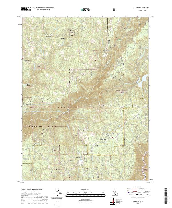
2022 Map of Clipper Mills
USGS Topo · Published 2022About this map
The S Fork Feather River carves a deep path through this high-country intersection of the Plumas National Forest and Tahoe National Forest. The landscape is defined by long, parallel ridges such as Lumpkin Ridge, Mooreville Ridge, and Fields Ridge, which dictate the placement of early mountain roads like La Porte Rd and Lumpkin Rd. Small mountain settlements and historical sites are scattered throughout, including Clipper Mills, Woodleaf, and Rogerville. The presence of the Woodleaf Tunnel Rd and names like Jackass Flat and Sucker Run hint at the area's legacy of resource extraction and early transport. Spanning the boundary of Butte and Yuba Counties, the map reveals a remote terrain where steep ravines like Bear Gulch and Eagle Gulch feed into the river system, supporting a network of creeks and timber-access routes.
Find a feature on this map
74 named features on this map. Tap any name to fly to it.
Don’t see what you’re looking for? This feature index may not catch every label — zoom into the map to look around manually.
Map Details
Editions of this 2022 Clipper Mills Map
This is the sole edition of this map. No revisions or reprints were ever made.
Other maps of this area

1888 · Smartsville
USGS Topo · 1:125,000

1888 · Bidwell Bar
USGS Topo · 1:125,000

1891 · Bidwell Bar
USGS Topo · 1:125,000

1891 · Smartsville
USGS Topo · 1:125,000

1892 · Smartsville
USGS Topo · 1:125,000

1893 · Bidwell Bar
USGS Topo · 1:125,000

1894 · Smartsville
USGS Topo · 1:125,000

1895 · Bidwell Bar
USGS Topo · 1:125,000

1895 · Smartsville
USGS Topo · 1:125,000

1897 · Bidwell Bar
USGS Topo · 1:125,000