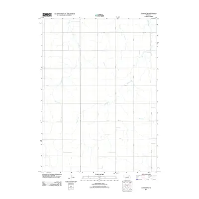
2011 Map of Closter NE
USGS Topo · Published 2011About this map
Giles Creek and Buffalo Creek wind through this rural section of Madison County, Nebraska, defining the low-lying drainage patterns of the Great Plains landscape. The area is structured by an exacting grid of section-line roads, such as 535 Ave and 836 Rd, which reflect the enduring influence of the Public Land Survey System on Midwestern agriculture and settlement. This 2011 survey documents a territory dominated by expansive open fields and ephemeral watercourses like Dry Creek and Deer Creek. The spatial layout reveals a high degree of land-use efficiency, where transport and water management are the primary human imprints on the land, offering a clear record of modern prairie infrastructure before more recent shifts in rural development.
Find a feature on this map
16 named features on this map. Tap any name to fly to it.
Don’t see what you’re looking for? This feature index may not catch every label — zoom into the map to look around manually.
Map Details
Editions of this 2011 Closter NE Map
This is the sole edition of this map. No revisions or reprints were ever made.
Other maps of this area

1955 · Sioux City
USGS Topo · 1:250,000

1955 · Fremont
USGS Topo · 1:250,000

1957 · Fremont
USGS Topo · 1:250,000

1958 · Sioux City
USGS Topo · 1:250,000

1958 · Fremont
USGS Topo · 1:250,000

1959 · Sioux City
USGS Topo · 1:250,000

1963 · Closter SW
USGS Topo · 1:24,000
1963 · Oakdale
USGS Topo · 1:24,000

1963 · Emerick
USGS Topo · 1:24,000

1963 · Meadow Grove
USGS Topo · 1:24,000