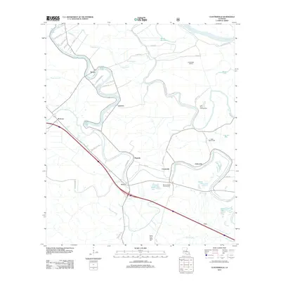
2012 Map of Cloutierville
USGS Topo · Published 2012About this map
Cane River Lake meanders through the heart of this Natchitoches Parish landscape, tracing an ancient course of the Red River that now supports a string of historic settlements. The map documents a corridor of heritage sites including Melrose, Magnolia, and Cloutierville, where the proximity of the waterway historically defined the agricultural and social fabric of the region. To the north, Cordosche Island is bounded by the current Red River and Bayou Bourbeaux, highlighting the shifting hydrologic patterns of the Louisiana lowlands.
Find a feature on this map
51 named features on this map. Tap any name to fly to it.
Don’t see what you’re looking for? This feature index may not catch every label — zoom into the map to look around manually.
Map Details
Editions of this 2012 Cloutierville Map
This is the sole edition of this map. No revisions or reprints were ever made.
Other maps of this area

1935 · Verda
USGS Topo · 1:31,680

1937 · Chopin NE
USGS Topo · 1:31,680

1937 · Bermuda
USGS Topo · 1:31,680

1937 · Chopin NW
USGS Topo · 1:31,680

1937 · Aloha
USGS Topo · 1:31,680

1937 · Montgomery
USGS Topo · 1:62,500

1937 · Cloutierville
USGS Topo · 1:31,680

1937 · Cypress
USGS Topo · 1:31,680

1942 · Kisatchie
USGS Topo · 1:62,500

1942 · Montgomery
USGS Topo · 1:62,500