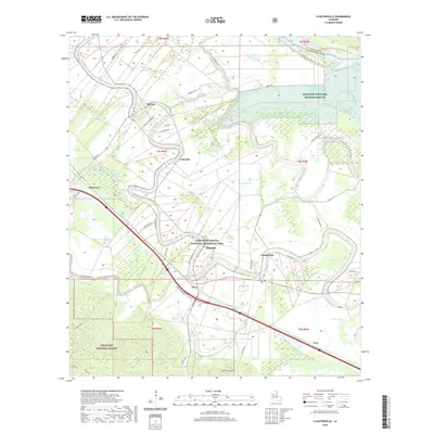
2020 Map of Cloutierville
USGS Topo · Published 2020About this map
The Cane River meanders through a landscape defined by historic plantation-era geography and significant conservation lands in Natchitoches Parish. The Cane River Creole National Historical Park preserves a tangible connection to the region's agricultural past near Magnolia and Derry. This modern survey reveals a complex network of bayous and former river channels, including Old River and Little River, which speak to the dynamic nature of the Red River floodplain. Surrounding the small settlements of Cloutierville, Melrose, and Lakeview, the map shows a mix of protected wetlands and forests, such as the Red River National Wildlife Refuge and portions of the Kisatchie National Forest. Notable elevation changes appear at Sang Pour Sang Hill and Backbone, providing a sharp contrast to the low-lying basins of Hertzog Swamp and Frost Jackson Swamp.
Find a feature on this map
61 named features on this map. Tap any name to fly to it.
Don’t see what you’re looking for? This feature index may not catch every label — zoom into the map to look around manually.
Map Details
Editions of this 2020 Cloutierville Map
This is the sole edition of this map. No revisions or reprints were ever made.
Other maps of this area

1935 · Verda
USGS Topo · 1:31,680

1937 · Chopin NE
USGS Topo · 1:31,680

1937 · Bermuda
USGS Topo · 1:31,680

1937 · Chopin NW
USGS Topo · 1:31,680

1937 · Aloha
USGS Topo · 1:31,680

1937 · Montgomery
USGS Topo · 1:62,500

1937 · Cloutierville
USGS Topo · 1:31,680

1937 · Cypress
USGS Topo · 1:31,680

1942 · Kisatchie
USGS Topo · 1:62,500

1942 · Montgomery
USGS Topo · 1:62,500