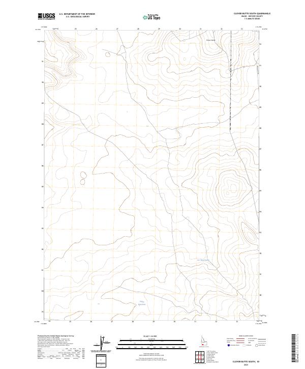
2023 Map of Clover Butte South
USGS Topo · Published 2023About this map
The high plateau of Owyhee County is defined by the prominent volcanic profile of Clover Butte in this contemporary study of the Idaho rangeland. The landscape is characterized by its isolation and the critical importance of water management in a high-desert environment, evidenced by livestock-sustaining features like Valley Waterhole and Leo Waterhole. These localized water sources are the primary landmarks in an area otherwise dominated by the vast township and range divisions of t12s r9e and t13s r9e. Three Creek Rd provides the only significant terrestrial artery through the eastern edge of the quadrangle, serving as a lifeline for the remote ranching operations and public land management that dictate the region's modern geography.
Find a feature on this map
8 named features on this map. Tap any name to fly to it.
Don’t see what you’re looking for? This feature index may not catch every label — zoom into the map to look around manually.
Map Details
Editions of this 2023 Clover Butte South Map
This is the sole edition of this map. No revisions or reprints were ever made.
Other maps of this area

1955 · Twin Falls
USGS Topo · 1:250,000

1958 · Twin Falls
USGS Topo · 1:250,000

1978 · The Arch
USGS Topo · 1:24,000

1979 · Stiff Tree Draw
USGS Topo · 1:24,000

1979 · Clover Butte South
USGS Topo · 1:24,000

1979 · Mosquito Lake Butte
USGS Topo · 1:24,000
1979 · Poison Butte
USGS Topo · 1:24,000
1979 · Inside Lakes
USGS Topo · 1:24,000

1980 · Juniper Butte
USGS Topo · 1:24,000

1980 · Clover Butte North
USGS Topo · 1:24,000