
1979 Map of Stiff Tree Draw
USGS Topo · Published 1979About this map
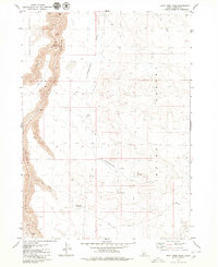
Bruneau Canyon dominates the western portion of this Owyhee County landscape, where steep cliffs drop away from the surrounding high plateaus. The topography is defined by the contrast between the deep gorge and the arid expanses of the Blackstone Desert and Inside Desert. Human activity in this remote high-desert environment is represented by the isolated Bengoechea Cabin, likely serving as a seasonal outpost for livestock operations. Drainage systems like Sheepshead Draw, Stiff Tree Draw, and Juniper Tree Draw provide the primary geographic structure for the plains above the canyon. Rare geological features are noted along the canyon walls, including a Natural Arch and various caves, which suggest a terrain shaped by long-term erosion and volcanic history. A network of jeep trails provides the only recorded access through this sparsely developed region.
Find a feature on this map
15 named features on this map. Tap any name to fly to it.
Don’t see what you’re looking for? This feature index may not catch every label — zoom into the map to look around manually.
Map Details
Editions of this 1979 Stiff Tree Draw Map
2 editions found
Other maps of this area

1955 · Twin Falls
USGS Topo · 1:250,000

1956 · Blue Butte
USGS Topo · 1:62,500

1956 · Winter Camp
USGS Topo · 1:62,500

1958 · Twin Falls
USGS Topo · 1:250,000

1979 · Indian Hot Springs
USGS Topo · 1:24,000

1979 · Clover Butte South
USGS Topo · 1:24,000

1979 · Cave Draw
USGS Topo · 1:24,000
1979 · Inside Lakes
USGS Topo · 1:24,000
1980 · Austin Butte
USGS Topo · 1:24,000

1980 · Clover Butte North
USGS Topo · 1:24,000