
1956 Map of Winter Camp
USGS Topo · Published 1958About this map
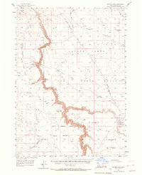
Bruneau Canyon dominates the western portion of this high desert landscape, its deep course carved through the volcanic plateau of southern Idaho. The map reveals a land defined by isolation and military utility in the mid-1950s, notably through the presence of the Aerial Gunnery Range and the Military Reservation Boundary that bisects the central plain. Settlement is sparse, with Winter Camp and a handful of remote gaging stations serving as the only named habitation points.
Find a feature on this map
36 named features on this map. Tap any name to fly to it.
Don’t see what you’re looking for? This feature index may not catch every label — zoom into the map to look around manually.
Map Details
Editions of this 1956 Winter Camp Map
2 editions found
Other maps of this area

1947 · Bruneau
USGS Topo · 1:62,500

1947 · Sugar Valley
USGS Topo · 1:24,000

1947 · Hot Spring
USGS Topo · 1:24,000

1948 · Sugar Valley
USGS Topo · 1:24,000

1948 · Indian Cove
USGS Topo · 1:62,500

1948 · Glenns Ferry
USGS Topo · 1:62,500

1948 · Pence Butte
USGS Topo · 1:24,000
1949 · Pot Hole Canyon
USGS Topo · 1:24,000
1949 · Pence Butte
USGS Topo · 1:24,000
1949 · Hot Spring
USGS Topo · 1:24,000