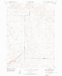
1949 Map of Pot Hole Canyon
USGS Topo · Published 1949About this map
Pot Hole Canyon and its namesake drainage, Pot Hole Creek, dominate this high-desert landscape along the boundary between Owyhee and Elmore counties. Mapped just after the Second World War, the terrain is defined by the sharp incisions of seasonal watercourses like Sailor Creek as they cut through the plateau. The only significant infrastructure shown is the unpaved Pot Hole Road, which winds through the western portion of the quadrangle. This 1949 edition is particularly valuable for its depiction of the pre-modern road network and original drainage patterns in a remote section of the Idaho backcountry, documented before later land-use changes altered the area's primitive access routes.
Find a feature on this map
6 named features on this map. Tap any name to fly to it.
Don’t see what you’re looking for? This feature index may not catch every label — zoom into the map to look around manually.
Map Details
Editions of this 1949 Pot Hole Canyon Map
2 editions found
Other maps of this area

1947 · Indian Cove
USGS Topo · 1:24,000

1947 · Hammett
USGS Topo · 1:24,000

1947 · Glenns Ferry
USGS Topo · 1:24,000

1948 · Hammett
USGS Topo · 1:24,000

1948 · Glenns Ferry
USGS Topo · 1:24,000

1948 · Indian Cove
USGS Topo · 1:24,000

1948 · Indian Cove
USGS Topo · 1:62,500

1948 · Glenns Ferry
USGS Topo · 1:62,500

1948 · Pence Butte
USGS Topo · 1:24,000

1948 · Grindstone Butte
USGS Topo · 1:24,000