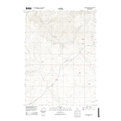
2013 Map of Clover Mountain
USGS Topo · Published 2013About this map
Clover Mtn and Rough Mountain dominate this corner of Owyhee County, where the high desert landscape is defined by a network of drainage systems and seasonal water sources. The map highlights the essential role of water in this arid environment, naming numerous sites such as Rat Spring, Rock Spring, and Clover Spring, alongside the Sheep Cr Pond. These landmarks were historically vital for livestock and local travel through the southwest Idaho rangelands.
Find a feature on this map
29 named features on this map. Tap any name to fly to it.
Don’t see what you’re looking for? This feature index may not catch every label — zoom into the map to look around manually.
Map Details
Editions of this 2013 Clover Mountain Map
This is the sole edition of this map. No revisions or reprints were ever made.
Other maps of this area

1955 · Jordan Valley
USGS Topo · 1:250,000

1957 · Jordan Valley
USGS Topo · 1:250,000

1958 · Jordan Valley
USGS Topo · 1:250,000

1965 · Triangle
USGS Topo · 1:62,500
1972 · Rough Mountain
USGS Topo · 1:24,000
1972 · Pixley Basin
USGS Topo · 1:24,000
1972 · Big Springs Ranch
USGS Topo · 1:24,000
1972 · Crab Spring Butte
USGS Topo · 1:24,000
1972 · Snow Creek
USGS Topo · 1:24,000
1972 · Clover Mtn
USGS Topo · 1:24,000