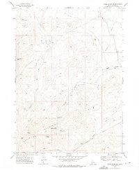
1972 Map of Rough Mountain
USGS Topo · Published 1975About this map
Doyle Place stands as a singular named habitation in this high-desert landscape of southwestern Idaho, situated north of the prominent Rough Mountain range. Surveyed in the early 1970s, the terrain is defined by its critical water sources, which dictated the movement of people and livestock through the Owyhee backcountry. A network of Jeep Trails and unnamed Trails connects various remote points such as Doyle Mountain and Horsehead Spring, illustrating the importance of access in a region where travel was constrained by the local drainage systems. The presence of a Prospect near the headwaters of Birch Creek suggests small-scale mineral exploration common to this era. Notable landmarks like Little Half Moon Pass and the Mud Flat Road provide essential orientation for those navigating between Poison Creek and the southern springs.
Find a feature on this map
23 named features on this map. Tap any name to fly to it.
Don’t see what you’re looking for? This feature index may not catch every label — zoom into the map to look around manually.
Map Details
Editions of this 1972 Rough Mountain Map
This is the sole edition of this map. No revisions or reprints were ever made.
Other maps of this area

1947 · Grand View
USGS Topo · 1:62,500

1947 · Vinson Wash
USGS Topo · 1:24,000

1947 · Perjue Canyon
USGS Topo · 1:24,000

1948 · Perjue Canyon
USGS Topo · 1:24,000

1948 · Vinson Wash
USGS Topo · 1:24,000

1955 · Jordan Valley
USGS Topo · 1:250,000

1957 · Jordan Valley
USGS Topo · 1:250,000

1958 · Jordan Valley
USGS Topo · 1:250,000
1972 · Rough Mountain NE
USGS Topo · 1:24,000
1972 · Pixley Basin
USGS Topo · 1:24,000