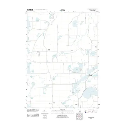
2011 Map of Cloverdale
USGS Topo · Published 2011About this map
Glacial lakes and small rural settlements dominate this section of Barry County, captured here in the early 21st century. The landscape is characterized by its high density of water bodies, from the large Gun Lake and Wall Lake to smaller basins like Snow Lake and Mud Lake. The settlement of Cloverdale serves as a local hub, featuring the Cloverdale Post Office near the shores of Cloverdale Lake and the uniquely named Number Twenty-one Lake.
Find a feature on this map
112 named features on this map. Tap any name to fly to it.
Don’t see what you’re looking for? This feature index may not catch every label — zoom into the map to look around manually.
Map Details
Editions of this 2011 Cloverdale Map
This is the sole edition of this map. No revisions or reprints were ever made.
Other maps of this area

1916 · Kalamazoo
USGS Topo · 1:62,500

1918 · Kalamazoo
USGS Topo · 1:62,500

1918 · Galesburg
USGS Topo · 1:62,500

1943 · Kalamazoo
USGS Topo · 1:62,500

1944 · Galesburg
USGS Topo · 1:62,500

1947 · Delton
USGS Topo · 1:24,000

1947 · Banfield
USGS Topo · 1:24,000

1947 · Galesburg
USGS Topo · 1:62,500

1950 · Galesburg
USGS Topo · 1:62,500

1951 · Hastings
USGS Topo · 1:62,500
Featured Places
- Prairieville, MI
- Yankee Springs Township, MI
- Barry Township, MI
- Orangeville Township, MI
- Circle Pines Center, MI