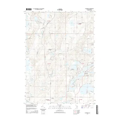
2014 Map of Cloverdale
USGS Topo · Published 2014About this map
The village of Cloverdale sits at the heart of this Barry County landscape, characterized by an exceptionally dense network of glacial lakes and wetlands. The settlement pattern here is closely tied to these water bodies, with the residential hub of Delton in the south and the Circle Pine Center further north. The map documents numerous historic burial grounds, including Jesuit Cem, McCallum Cem, and the Prairieville Township Cem, which offer significant value for genealogical research in Prairieville.
Find a feature on this map
134 named features on this map. Tap any name to fly to it.
Don’t see what you’re looking for? This feature index may not catch every label — zoom into the map to look around manually.
Map Details
Editions of this 2014 Cloverdale Map
This is the sole edition of this map. No revisions or reprints were ever made.
Other maps of this area

1916 · Kalamazoo
USGS Topo · 1:62,500

1918 · Kalamazoo
USGS Topo · 1:62,500

1918 · Galesburg
USGS Topo · 1:62,500

1943 · Kalamazoo
USGS Topo · 1:62,500

1944 · Galesburg
USGS Topo · 1:62,500

1947 · Delton
USGS Topo · 1:24,000

1947 · Banfield
USGS Topo · 1:24,000

1947 · Galesburg
USGS Topo · 1:62,500

1950 · Galesburg
USGS Topo · 1:62,500

1951 · Hastings
USGS Topo · 1:62,500
Featured Places
- Prairieville, MI
- Yankee Springs Township, MI
- Barry Township, MI
- Orangeville Township, MI
- Circle Pines Center, MI