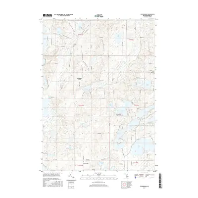
2017 Map of Cloverdale
USGS Topo · Published 2017About this map
Wall Lake and the dense cluster of nearby water bodies define this portion of Barry County, where the landscape is a complex network of glacial kettles and marshes. The settlement of Delton sits at the southern edge of this aquatic corridor, serving as a local hub near Cloverdale Lake and Wilkinson Lake. Further west, the crossroads of Prairieville marks a transition toward more agricultural terrain, anchored by the Prairieville Township Cem. This area is notable for its numerous small, named lakes like Tamarack Lake, Wiley Lake, and Loomis Lake, which reflect the region's post-glacial topography. Genealogy researchers will find several family and institutional burial grounds, including the Jesuit Cem and McCallum Cem, while the Circle Pine Center stands as a distinct cultural landmark. The presence of named tracks like Stewart Lake Trl and Sager Trl indicates a landscape heavily utilized for both local transit and recreation among the timber and wetlands.
Find a feature on this map
113 named features on this map. Tap any name to fly to it.
Don’t see what you’re looking for? This feature index may not catch every label — zoom into the map to look around manually.
Map Details
Editions of this 2017 Cloverdale Map
This is the sole edition of this map. No revisions or reprints were ever made.
Other maps of this area

1916 · Kalamazoo
USGS Topo · 1:62,500

1918 · Kalamazoo
USGS Topo · 1:62,500

1918 · Galesburg
USGS Topo · 1:62,500

1943 · Kalamazoo
USGS Topo · 1:62,500

1944 · Galesburg
USGS Topo · 1:62,500

1947 · Delton
USGS Topo · 1:24,000

1947 · Banfield
USGS Topo · 1:24,000

1947 · Galesburg
USGS Topo · 1:62,500

1950 · Galesburg
USGS Topo · 1:62,500

1951 · Hastings
USGS Topo · 1:62,500
Featured Places
- Prairieville, MI
- Yankee Springs Township, MI
- Barry Township, MI
- Orangeville Township, MI
- Circle Pines Center, MI