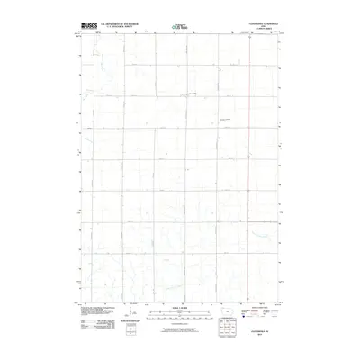
2010 Map of Cloverdale
USGS Topo · Published 2010About this map
Cloverdale serves as the central focal point for this section of Osceola County, reflecting a landscape defined by an orderly grid of section roads and agricultural drainages. The Goewey Township Cemetery stands as a quiet marker of the area's local heritage, situated along Redwood Ave. The map captures a transitional geography where northern Iowa plains are bisected by several key waterways. The North Fork Floyd River meanders across the southern portion, while Otter Creek and Kappes Creek cut through the western reaches. Small settlements like Gopher dot the section lines, connected by thoroughfares such as Oriole Ave and Pierce Ave, illustrating the enduring spatial organization of the rural Midwest.
Find a feature on this map
18 named features on this map. Tap any name to fly to it.
Don’t see what you’re looking for? This feature index may not catch every label — zoom into the map to look around manually.
Map Details
Editions of this 2010 Cloverdale Map
This is the sole edition of this map. No revisions or reprints were ever made.
Other maps of this area

1954 · Fairmont
USGS Topo · 1:250,000

1958 · Fairmont
USGS Topo · 1:250,000

1964 · Sheldon
USGS Topo · 1:24,000

1964 · Plessis
USGS Topo · 1:24,000

1964 · Sanborn
USGS Topo · 1:24,000

1972 · Ashton
USGS Topo · 1:24,000

1972 · Ocheyedan
USGS Topo · 1:24,000

1972 · Sibley West
USGS Topo · 1:24,000

1972 · Cloverdale
USGS Topo · 1:24,000
1972 · Sibley East
USGS Topo · 1:24,000