
1972 Map of Ocheyedan
USGS Topo · Published 1975About this map
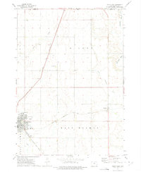
Ocheyedan Mound rises as a prominent landmark in this prairie landscape of northwestern Iowa during the early 1970s. This survey records the town of Ocheyedan, situated where the Chicago Rock Island and Pacific railroad crosses the Ocheyedan River. The local geography is defined by glacial drainage patterns, featuring the Little Ocheyedan River and Osterman Creek winding through the townships of Horton and Ocheyedan. To the east, the Rush Lake State Game Management Area surrounds Rush Lake, with the Rush Lake Outlet feeding southward. Rural infrastructure of the era is represented by the Zion Sch and several Gravel Pits, while a Roadside Park along the highway north of town serves travelers. This period map captures the community just as it maintained its role as a regional rail and agricultural hub for Osceola County.
Find a feature on this map
21 named features on this map. Tap any name to fly to it.
Don’t see what you’re looking for? This feature index may not catch every label — zoom into the map to look around manually.
Map Details
Editions of this 1972 Ocheyedan Map
This is the sole edition of this map. No revisions or reprints were ever made.
Other maps of this area

1954 · Fairmont
USGS Topo · 1:250,000

1958 · Fairmont
USGS Topo · 1:250,000

1960 · Bigelow
USGS Topo · 1:24,000

1960 · Worthington South
USGS Topo · 1:24,000

1960 · Round Lake
USGS Topo · 1:24,000

1970 · May City
USGS Topo · 1:24,000

1970 · Harris
USGS Topo · 1:24,000

1972 · Cloverdale
USGS Topo · 1:24,000
1972 · Sibley East
USGS Topo · 1:24,000
1972 · Melvin
USGS Topo · 1:24,000