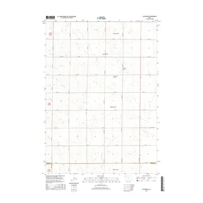
2015 Map of Cloverdale
USGS Topo · Published 2015About this map
The Cloverdale settlement sits atop the highland terrain of the Coteau des Prairies, an elevated plateau that shapes the hydrology of this Northwest Iowa landscape. Situated in the southern reaches of Osceola County, the area is defined by a grid of rural roads and the headwaters of regional drainages. The N Fork Floyd River flows south through the central sections, while Otter Cr and Kappes Cr carve distinct drainage patterns across the northern and western townships. For local historians, the Goewey Township Cem provides a specific point of genealogical interest within this strictly surveyed agricultural region. The map also delineates the boundary between Osceola and O'Brien Counties, documenting the intersection of local jurisdictions at the turn of the 21st century.
Find a feature on this map
34 named features on this map. Tap any name to fly to it.
Don’t see what you’re looking for? This feature index may not catch every label — zoom into the map to look around manually.
Map Details
Editions of this 2015 Cloverdale Map
This is the sole edition of this map. No revisions or reprints were ever made.
Other maps of this area

1954 · Fairmont
USGS Topo · 1:250,000

1958 · Fairmont
USGS Topo · 1:250,000

1964 · Sheldon
USGS Topo · 1:24,000

1964 · Plessis
USGS Topo · 1:24,000

1964 · Sanborn
USGS Topo · 1:24,000

1972 · Ashton
USGS Topo · 1:24,000

1972 · Ocheyedan
USGS Topo · 1:24,000

1972 · Sibley West
USGS Topo · 1:24,000

1972 · Cloverdale
USGS Topo · 1:24,000
1972 · Sibley East
USGS Topo · 1:24,000