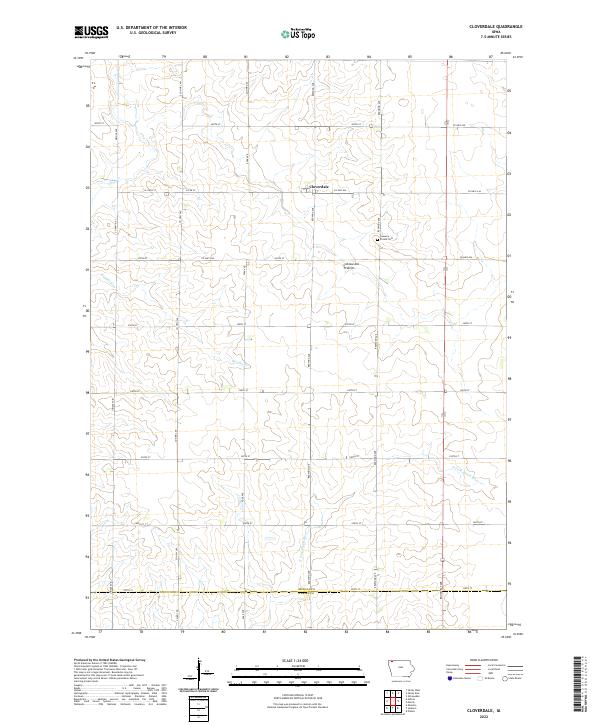
2022 Map of Cloverdale
USGS Topo · Published 2022About this map
Cloverdale sits at the intersection of rural highways in northwestern Iowa, anchoring a landscape shaped by the Coteau des Prairies upland. This survey captures the agricultural grid of Osceola County as it appeared in 2022, shortly before crossing the Osceola and O'Brien County line. The map reveals the hydrology of the region, where the N Fork Floyd River begins its course amidst a network of smaller streams like Otter Cr and Kappes Cr. For genealogists and local historians, the Goewey Prairie Cem serves as a significant landmark, preserved among the section lines and gravel roads that define this prairie terrain. The map's detail provides a clear view of the modern land divisions and drainage patterns that continue to support the area's farming heritage.
Find a feature on this map
34 named features on this map. Tap any name to fly to it.
Don’t see what you’re looking for? This feature index may not catch every label — zoom into the map to look around manually.
Map Details
Editions of this 2022 Cloverdale Map
This is the sole edition of this map. No revisions or reprints were ever made.
Other maps of this area

1954 · Fairmont
USGS Topo · 1:250,000

1958 · Fairmont
USGS Topo · 1:250,000

1964 · Sheldon
USGS Topo · 1:24,000

1964 · Plessis
USGS Topo · 1:24,000

1964 · Sanborn
USGS Topo · 1:24,000

1972 · Ashton
USGS Topo · 1:24,000

1972 · Ocheyedan
USGS Topo · 1:24,000

1972 · Sibley West
USGS Topo · 1:24,000

1972 · Cloverdale
USGS Topo · 1:24,000
1972 · Sibley East
USGS Topo · 1:24,000