
1972 Map of Cloverdale
USGS Topo · Published 1975About this map
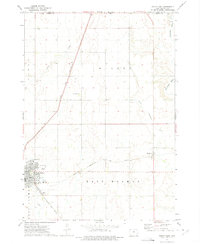
Cloverdale serves as a central rail point in this Iowa landscape, situated along the Chicago Rock Island and Pacific railroad line. The surrounding territory is defined by the agricultural layout of several townships, including East Holman, West Holman, Gilman, and Goewey. Waterways like Otter Creek in the north and the North Fork Floyd River in the south carve through the sectioned fields, dictating the natural drainage patterns of the prairie. Small industrial markers like a Gravel Pit and Sandpit indicate local resource extraction during the early 1970s. The map also records the jurisdictional boundary of Osceola Co O'Brien Co, providing a clear view of the rural infrastructure and land management at this moment in the state's history.
Find a feature on this map
13 named features on this map. Tap any name to fly to it.
Don’t see what you’re looking for? This feature index may not catch every label — zoom into the map to look around manually.
Map Details
Editions of this 1972 Cloverdale Map
This is the sole edition of this map. No revisions or reprints were ever made.
Other maps of this area

1954 · Fairmont
USGS Topo · 1:250,000

1958 · Fairmont
USGS Topo · 1:250,000

1964 · Sheldon
USGS Topo · 1:24,000

1964 · Plessis
USGS Topo · 1:24,000

1964 · Sanborn
USGS Topo · 1:24,000

1972 · Ashton
USGS Topo · 1:24,000

1972 · Ocheyedan
USGS Topo · 1:24,000

1972 · Sibley West
USGS Topo · 1:24,000
1972 · Sibley East
USGS Topo · 1:24,000
1972 · Melvin
USGS Topo · 1:24,000