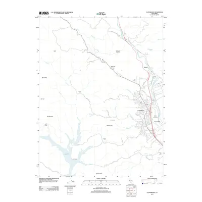
2012 Map of Cloverdale
USGS Topo · Published 2012About this map
Cloverdale serves as the hub of this Northern Sonoma County landscape, situated where the Russian River valley meets the foothills of the Coast Ranges. The map illustrates a transitional geography between active agriculture and rugged heights, featuring the Bandiera Winery and Cloverdale Rancheria near the town center. Local heritage is marked by The Settlers Tree and the Cloverdale Cem, while the surrounding terrain is defined by prominent elevations like Morris Peak, Red Mountain, and Redwood Mountain. To the west, the massive expanse of Lake Sonoma reaches into the hills, fed by numerous creeks including Cherry Cr and Yorty Cr. The rural outskirts are dotted with established homesteads such as Cooper Ranch, Pardini Ranch, and Ledford Ranch, reflecting a long history of land use. Transportation corridors like N Redwood Hwy and the winding Oat Valley Cr trace the natural contours of the valley floor.
Find a feature on this map
64 named features on this map. Tap any name to fly to it.
Don’t see what you’re looking for? This feature index may not catch every label — zoom into the map to look around manually.
Map Details
Editions of this 2012 Cloverdale Map
This is the sole edition of this map. No revisions or reprints were ever made.
Other maps of this area

1920 · Healdsburg
USGS Topo · 1:62,500

1921 · Skaggs
USGS Topo · 1:62,500

1921 · Kelseyville
USGS Topo · 1:62,500

1933 · Healdsburg
USGS Topo · 1:48,000

1938 · Hopland
USGS Topo · 1:62,500

1940 · Healdsburg
USGS Topo · 1:62,500

1943 · Tombs Creek
USGS Topo · 1:24,000

1943 · Skaggs Springs
USGS Topo · 1:24,000

1943 · Kelseyville
USGS Topo · 1:62,500

1943 · Hopland
USGS Topo · 1:62,500