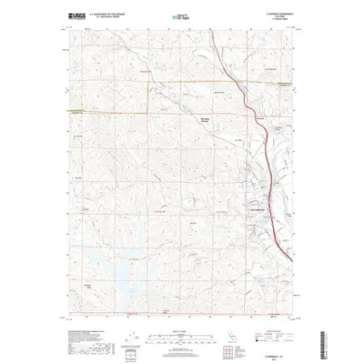
2018 Map of Cloverdale
USGS Topo · Published 2018About this map
Cloverdale serves as the focal point of this northern Sonoma County landscape, situated where the Russian River valley opens south of the Mendocino County line. The settlement pattern shows a transition from the structured street grid of the town center to the surrounding agricultural and mountain terrain. To the north, the small community of Preston is tucked near the river, while to the south, the expansive waters of Lake Sonoma are visible, fed by Brush Creek and Smith Creek. The topography is defined by significant elevations like Redwood Mtn and Pritchett Peaks, framing the fertile Alexander Valley and Oat Valley. Local history is anchored by landmarks such as the Cloverdale Cem and the former resort area at Alderglen Springs, illustrating the region's long-standing connection to both viticulture and the natural springs of the Coastal Range.
Find a feature on this map
89 named features on this map. Tap any name to fly to it.
Don’t see what you’re looking for? This feature index may not catch every label — zoom into the map to look around manually.
Map Details
Editions of this 2018 Cloverdale Map
This is the sole edition of this map. No revisions or reprints were ever made.
Other maps of this area

1920 · Healdsburg
USGS Topo · 1:62,500

1921 · Skaggs
USGS Topo · 1:62,500

1921 · Kelseyville
USGS Topo · 1:62,500

1933 · Healdsburg
USGS Topo · 1:48,000

1938 · Hopland
USGS Topo · 1:62,500

1940 · Healdsburg
USGS Topo · 1:62,500

1943 · Tombs Creek
USGS Topo · 1:24,000

1943 · Skaggs Springs
USGS Topo · 1:24,000

1943 · Kelseyville
USGS Topo · 1:62,500

1943 · Hopland
USGS Topo · 1:62,500