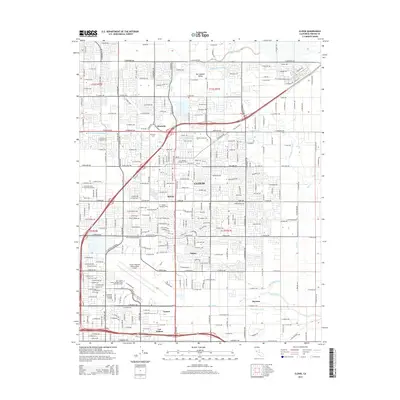
2015 Map of Clovis
USGS Topo · Published 2015About this map
Clovis and the surrounding northeast Fresno suburbs are defined by a complex network of irrigation and drainage that has supported the San Joaquin Valley for over a century. This 2015 survey details the sophisticated water infrastructure, including the Enterprise Canal, Clovis Ditch, and Helm Canal, which weave through residential developments and commercial hubs. The map illustrates the expansion of communities such as Glorietta, Tarpey, and Cameo, while also identifying significant educational institutions like the San Joaquin College of Law and the California Christian College. The southern portion of the sheet is dominated by the sprawling grounds of the Fresno Yosemite International Airport, contrasting with the more traditional local landmarks like the Clovis Cem. This document provides a clear view of how urban growth has integrated with historical water management systems like Mill Ditch and Redbank Slough.
Find a feature on this map
136 named features on this map. Tap any name to fly to it.
Don’t see what you’re looking for? This feature index may not catch every label — zoom into the map to look around manually.
Map Details
Editions of this 2015 Clovis Map
This is the sole edition of this map. No revisions or reprints were ever made.
Other maps of this area

1921 · Bullard
USGS Topo · 1:31,680

1922 · Round Mountain
USGS Topo · 1:31,680

1922 · Lanes Bridge
USGS Topo · 1:31,680

1922 · Friant
USGS Topo · 1:31,680

1923 · Malaga
USGS Topo · 1:31,680

1923 · Academy
USGS Topo · 1:31,680

1923 · Fresno
USGS Topo · 1:31,680

1923 · Clovis
USGS Topo · 1:31,680

1923 · Sanger
USGS Topo · 1:31,680

1923 · Bullard
USGS Topo · 1:31,680