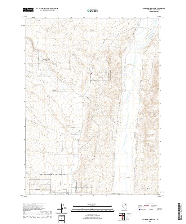
2021 Map of Coal Mine Canyon SE
USGS Topo · Published 2021About this map
Coal Mine Canyon anchors this high-desert landscape in Elko County, where the high-altitude terrain is defined by the drainage of Coal Mine Cr and Twelvemile Cr. The eastern portion of the survey is dominated by the meandering course of the N Fork Humboldt River, which flows through a wide valley before being constrained by the southern rise of the Peko Hills. Modern infrastructure, including Coal Mine Rd and Ryndon Rd, follows the natural contours of the land, tracing paths through township boundaries T37N R56E and T36N R57E. The map also captures the grid development south of the river, where residential-style naming conventions like Mesa Verde, Taft Ave, and 14th St suggest the organized expansion of rural settlements in the western Nevada desert.
Find a feature on this map
24 named features on this map. Tap any name to fly to it.
Don’t see what you’re looking for? This feature index may not catch every label — zoom into the map to look around manually.
Map Details
Editions of this 2021 Coal Mine Canyon SE Map
This is the sole edition of this map. No revisions or reprints were ever made.
Other maps of this area

1935 · Halleck
USGS Topo · 1:125,000

1955 · Wells
USGS Topo · 1:250,000

1955 · Elko
USGS Topo · 1:250,000

1958 · Wells
USGS Topo · 1:250,000

1958 · Elko
USGS Topo · 1:250,000

1961 · Wells
USGS Topo · 1:250,000

1962 · Elko
USGS Topo · 1:250,000

1962 · Ryndon
USGS Topo · 1:24,000

1962 · Osino
USGS Topo · 1:24,000

1965 · Elko
USGS Topo · 1:250,000